CASE STUDY | LEADING ENTERPRISE
Environmental Monitoring in rural areas with WatchEDGE
An advanced solution for wildlife and vegetation monitoring in remote rural environments, powered by AI and Edge Networking technologies.
Challenge
In the heart of rural areas—far from high-speed connectivity and modern technological infrastructure—preserving and managing the natural environment is a critical challenge.
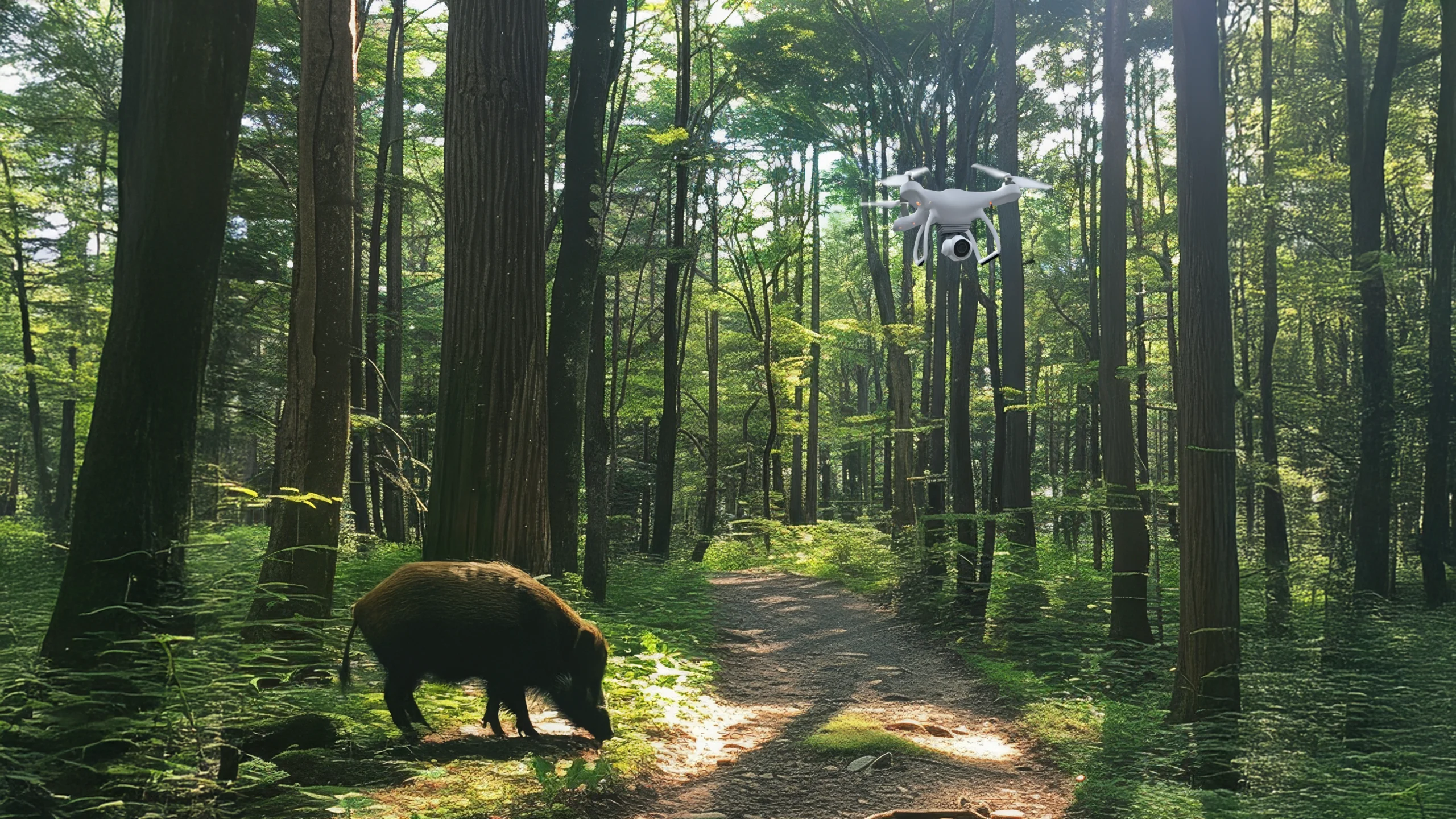
The San Rossore Wildlife Park, located between the city of Pisa and the Tyrrhenian Sea, has proven to be an ideal testing ground for the innovative environmental monitoring solutions developed within the WatchEDGE project. The park is home to a unique biodiversity, but the technical and logistical difficulties of monitoring such a remote area are significant.
Key issues include tracking the movements of animals—particularly wild boars, known for damaging crops and posing a danger to road safety—as well as early detection of diseases or pest attacks that could threaten the entire ecosystem.
In environments with limited resources, the challenges of collecting, processing, and interpreting data in real time, while minimizing human impact, are immense.
Solution
WatchEDGE addresses these challenges with a cutting-edge solution that combines Artificial Intelligence (AI), decentralized machine learning, and Edge Networking, enabling real-time environmental monitoring even in the most isolated rural areas.
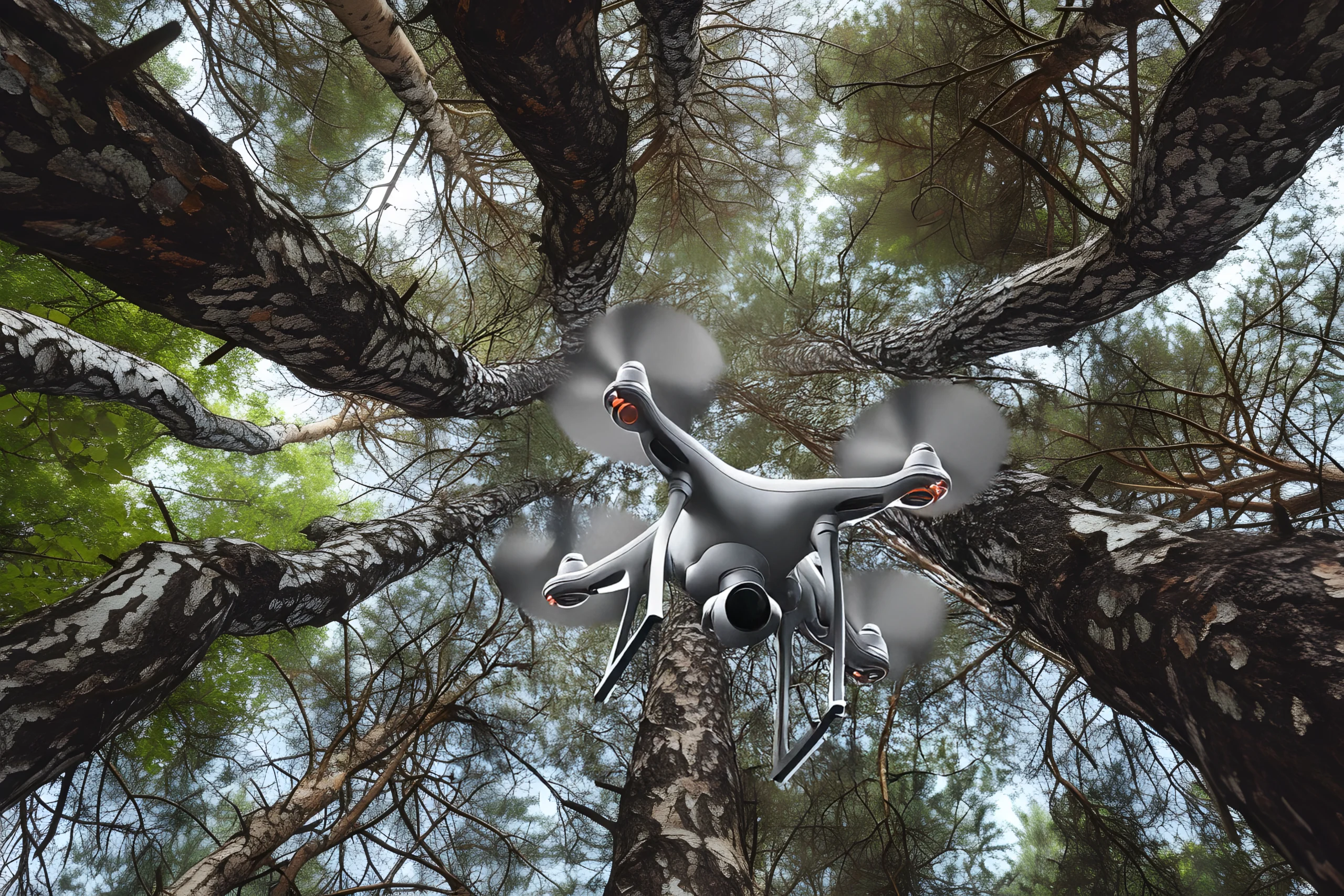
At the core of the system is image-based recognition, which allows for tracking animal movements and monitoring plant health. Drones and smart cameras capture images from multiple angles, ensuring comprehensive and accurate coverage, even in hard-to-reach locations.
The AI model was trained to recognize wild boars, distinguish between individual animals, and provide detailed insights into movement patterns, offering valuable information about population behavior.
During the tests conducted in the Pineta Torre Riccardi area of the San Rossore Park, innovative monitoring methods were employed alongside traditional wildlife census techniques based on manual observation.
To enable real-time data processing in the field, two prototypes of nomadic Edge Computing were tested: one developed by Italtel and another integrated within the 5G Nomad system. This made it possible to collect and process images and videos locally, optimizing data flows even in the absence of fixed connectivity.
The 5G Nomad served as a mobile wireless network infrastructure to support communication between sensors and distributed computing nodes. Alternative solutions like Wi-Fi were also tested, considering the need to operate in areas without private 5G coverage.
Another key technological component was the experimentation with SD-WAN, which enables the integration of multiple network types (Wi-Fi, 4G, 5G, satellite) to ensure a stable and efficient connection even in the most remote areas.
A key feature of the solution is the use of Distributed Federated Learning, enabling the model to be trained collaboratively across multiple monitoring islands. This decentralized approach ensures that data remains within its local context, while requiring high local processing efficiency. It also reduces connectivity demands and avoids centralizing information in a single geographic point.
Benefits
The benefits of the WatchEDGE solution go far beyond traditional monitoring. Here are some of the main advantages:
-
Real-time tracking: Continuously observe animal behavior and plant health, enabling operators to intervene quickly and prevent critical situations.
-
Integrated management: The platform connects fragmented, pre-existing technologies, creating an interoperable ecosystem for coordinated and efficient land management.
-
Low-maintenance technology: Autonomous, low-power devices connected via flexible networks (Wi-Fi, mobile, satellite) ensure operability even without electricity or fixed connectivity.
-
Scalability and flexibility: Initially designed for wild boars, the system can be easily adapted to other species such as deer, foxes, and wolves.
-
Unified cloud dashboard: A centralized, real-time cloud-based dashboard provides clear visibility for environmental managers and field operators.
-
Sustainable design: Engineered to minimize environmental impact, the solution blends technological efficiency with biodiversity conservation.
Italtel’s role
Italtel played a pivotal role in the success of the WatchEDGE project, bringing critical expertise in two areas: network infrastructure and data management.
Edge Network Infrastructure
Italtel designed an innovative Edge network, optimized for rural and remote environments, using a portable server and multiple connectivity methods. This allowed data processing to happen close to the source, reducing the need for high-capacity network transfers.
Cloud Dashboard
Italtel also developed a cloud dashboard for remote monitoring and real-time data management. This centralized tool helps operators quickly analyze and act on the data, increasing field operation efficiency and ensuring a high level of control and reliability.
An ecosystem of expertise driving innovation
WatchEDGE is part of the PNRR RESTART program, coordinated by Politecnico di Milano, and is built on a strong collaboration between academia, tech companies, and public institutions.
The consortium includes:
-
Three universities: University of Pisa, University of Catania, University of Milano-Bicocca
-
Three tech companies: Italtel, Nextworks, Sensor ID
-
One research center: CNIT – National Laboratory RaSS (Radar and Surveillance Systems), Pisa
In collaboration with the Ente Parco Regionale Migliarino, San Rossore, Massaciuccoli, the project benefited from a unique natural environment for testing and deploying advanced environmental monitoring technologies.
This multidisciplinary synergy is a virtuous model of cooperation between research, industry, and public administration, aiming for sustainable development and innovation in rural territories.
Scaling innovation beyond rural
The WatchEDGE project delivers an innovative and scalable solution for rural environmental monitoring. With the integration of AI, Edge Computing, and advanced networking technologies, it effectively addresses complex challenges like wildlife tracking and vegetation protection, optimizing resources and ensuring ecosystem sustainability.
Thanks to close collaboration with academic experts and the strategic support of Italtel, WatchEDGE has proven its ability to adapt to diverse scenarios, opening new possibilities for applications in emergency response, safety, and environmental conservation.
The solution, initially designed for rural areas, can also be extended to smart cities, agriculture, and industrial contexts. Potential use cases include disaster monitoring (e.g., landslides, floods), public safety, detection of panic situations in crowded areas, and intrusion detection in protected zones.
TECH KEYWORDS
EDGE COMPUTING FOR ENVIRONMENTAL MONITORING
FEDERATED LEARNING IN RURAL NETWORKS
REAL-TIME ENVIRONMENTAL DATA ANALYTICS
HIGH LOCAL PROCESSING EFFICIENCY
ADVANCED NETWORKING SOLUTION
SHARE THE PAGE